
These Canada worksheets will examine all the different regions of Canada using a wide range of discovery activities. You will start with a reading that covers all the major aspects of the provinces and territories. You will be provided with a blank map of each and be asked to highlight all the attractions, major cities, and resources in those regions. We ill will also provide you with a high definition map that makes everything more obvious as a reference. If you are looking for full maps, check the complete country of Canada maps at the bottom of this page. This collection of worksheets explores the history, geography, industry, etc. of each of the Canadian providences and territories, offering short reading passages, maps, and two questionnaires for each. Answer keys have also been provided for the questionnaires. Fun Fact: The United States and Canada share the world’s longest international border (5,525 miles) and the world’s shortest international bridge (Zavikon Island – 32 feet).
Print Canada Worksheets
Click the buttons to print each worksheet and associated answer key.
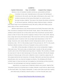
Alberta Reading Worksheet
Over 80% of the population of Alberta lives in the metropolitan Calgary-Edmonton area. This metro area is ranked high in quality of life and average income and is one of the fastest growing areas in Canada.

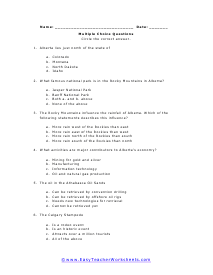
Alberta Multiple Choice
The Rocky Mountains influence the rainfall of Alberta. Which of the following statements describes this influence?
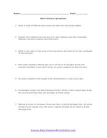
Alberta Short Answer
Explain why Alberta has just one four-lane highway and this interstate highway connects Calgary and Edmonton.
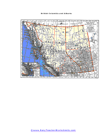
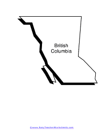
British Columbia and Alberta Map
A detailed map of the major parts of the two provinces. Includes upper Washington state (U.S.)
British Columbia Reading Worksheet
The economy is based upon the vast natural resources available in the area. Forests cover over half of British Columbia.
British Columbia Multiple Choice Questions
It is north of Washington State in the United States. A unique feature of British Columbia is that it also borders Alaska to the west.
British Columbia Short Answer
10.6% of the population of British Columbia is of Chinese heritage. If you interviewed 200 people walking through a shopping mall in Vancouver, how many people of Chinese heritage would you expect to talk with?
Manitoba Reading Worksheet
Manitoba, along with Alberta and Saskatchewan, are called the Prairie Provinces of Canada.
Manitoba Multiple Choice Questions
Manitoba contains over 100,000 lakes and is part of the prairie pothole region of North America that is the summer nesting grounds for many species of waterfowl, especially ducks and geese.
Manitoba Short Answer Questions
Manitoba is relatively flat ground in the middle of the continent so its weather is not influenced by the ocean or mountain ranges.
New Brunswick Reading Worksheet
New Brunswick, Nova Scotia and Prince Edward Island are known as Canada’s Maritime Provinces.
New Brunswick Multiple Choice Worksheet
About one-third of the people in New Brunswick speak French as their native language. Canada has a mixed culture across the country as far as whether English or French is generally spoken.
New Brunswick Short Answer
Historically forestry and the production of lumber products have been important to the New Brunswick economy.
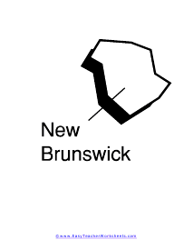
New Brunswick Outline
A large printable map. There is plenty of space to write and point out any major areas of interest.
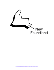
Newfoundland and Labrador Reading Worksheet
Newfoundland is an island in the Atlantic Ocean and the provincial capital of St. John's is located on the eastern tip of the island.
Newfoundland and Labrador Multiple Choice
The island and the mainland parts of the province have different climates. Newfoundland is generally humid and experiences weather similar to its neighboring province of New Brunswick. However, Labrador extends far enough north to be considered a polar tundra climate.
Newfoundland and Labrador Short Answer Questions
Labrador is largely uninhabited. The population density for the entire province of Newfoundland and Labrador is just 3.6 persons per square mile.
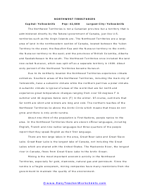
The Northwest Territories Reading Worksheet
The Northwest Territories is not a Canadian province but a territory that is administered directly by the federal government of Canada, just like U.S. territories such as the Virgin Islands are.
The Northwest Territories Multiple Choice Questions
Due to its northerly location the Northwest Territories experience climate extremes.
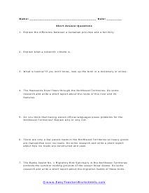
The Northwest Territories Short Answer Worksheet
In the Northwest Territories there are eleven official languages, including English, French and nine native languages but three-quarters of the people report that they speak English as their first language.
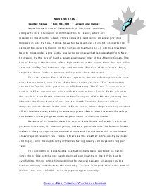
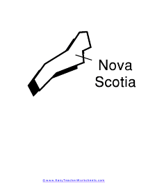
Nova Scotia Reading Worksheet
Nova Scotia is a large peninsula that is separated from New Brunswick by the Bay of Fundy, a large saltwater inlet of the Atlantic Ocean.
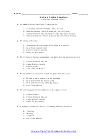
Nova Scotia Multiple Choice
Because of its location near the ocean, Nova Scotia is Canada's warmest province.
Nova Scotia Short Answer
The economy of Nova Scotia has traditionally been centered on fishing since the 1700s but the cod catch declined significantly in the 1990s due to overfishing.
Nunavut Reading Worksheet
The majority of people in Nunavut Territory are Inuit, who used to be called Eskimos by other people in North America.
Nunavut Multiple Choice Questions
The sections of Nunavut below the Arctic Circle have a subarctic climate which means the short summers can be hot while the long winter is very cold, with long periods of temperatures well below zero.
Nunavut Short Answer
The wildlife native to the territory includes the major arctic animals like polar bears, caribou, arctic fox, walruses and muskox.
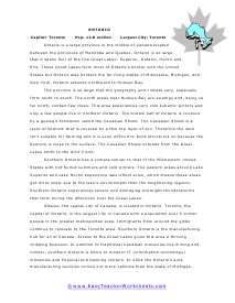
Ontario Reading Worksheet
The province is so large that the geography and climate vary, especially from north to south.
Ontario Multiple Choice Questions
Southern Ontario has a climate similar to that of the Midwestern United States with hot humid summers and cold winters. The eastern areas around Lake Superior and Lake Huron experience lake-effect snow, which means these areas get more snow due to the lake's environment than the neighboring regions.
Ontario Short Answer Questions
Ottawa, the capital city of Canada, is located in Ontario. Toronto, the capital of Ontario, is the largest city in Canada with a population over 5 million people in the greater metropolitan area.
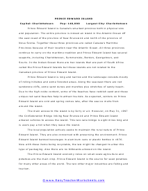
Prince Edward Island Reading Worksheet
Prince Edward Island is Canada's smallest province both in physical size and population.
Prince Edward Island Multiple Choice
Prince Edward Island is long and narrow and the landscape consists mostly of rolling hillsides and some forested areas.
Prince Edward Island Short Answer
The main access to the island is by ferry or air. However, on May 31, 1997 the Confederation Bridge linking New Brunswick and Prince Edward Island allowed vehicles to access the island.
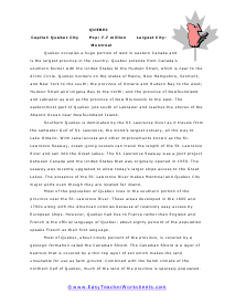
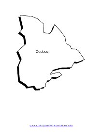
Quebec Reading Worksheet
Quebec occupies a huge portion of land in eastern Canada and is the largest province in the country.
Quebec Multiple Choice Questions
Quebec extends from Canada's southern border with the United States to the Hudson Strait, which is near to the Arctic Circle.
Quebec Short Answer
Combined with the harsh climate of the northern half of Quebec, much of the land of the province is sparsely populated.
Saskatchewan Reading Worksheet
Saskatchewan is an inland province in western Canada located between Manitoba to the east and Alberta to the west.
Saskatchewan Multiple Choice Questions
The glaciers that once covered vast areas of North America removed topsoil from large areas of Canada, leaving only bedrock covered with a thin layer of poor soil.
Saskatchewan Short Answer
Being a Prairie Province, Saskatchewan has historically been called The Bread Basket of Canada because of the amount of wheat grown there.
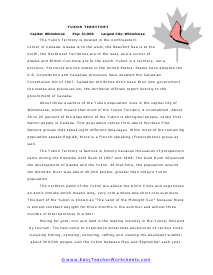
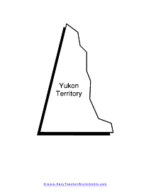
The Yukon Territory Reading Worksheet
Canadian territories don’t have their own government like states and provinces do; the territorial officials report directly to the government of Canada.
The Yukon Territory Multiple Choice
The Yukon Territory is famous in history because thousands of prospectors came during the Klondike Gold Rush of 1897 and 1898.
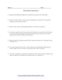
The Yukon Territory Short Answer Questions
The northern parts of the Yukon are above the Arctic Circle and experience an arctic climate which means long, very cold winters and short cool summers.
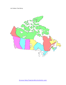
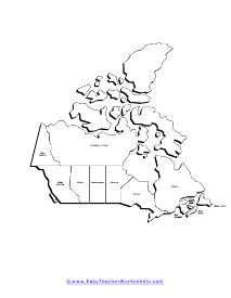
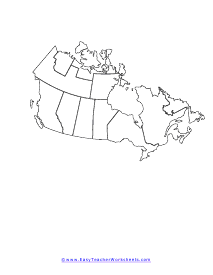
Blank Canada Country Map
A full sized blank version of the full country in a black and white composition map.
The Provinces and Territories of Canada
Found in the Northern portion of North America, Canada is a country rich in oil resources and land. Canada has thirteen percent of the world’s global oil reserves which is larger in frozen form. This makes it second only to Saudi Arabia. In addition, Canada has many metal natural resources mainly lead, nickel, and zinc. In terms of space, it the second largest country by total area. About forty million people call Canada home. As a country their citizens speak mainly on of two languages English and French (their official national language). Canada is made up of ten provinces and 3 territories. The worksheets above will help you explore all these places. Canada is located just north of the United States, on the other side of the 49th parallel. While many countries initially claimed land in Canada, it was primarily owned (and fought over) by France and England.
Canada has comprised ten provinces and three territories since 1999, when Nunavut joined the Canadian Confederation. Here, we explore some basic (and fun) facts about each of these 13 provinces and territories.
Here are the 13 official provinces (#1-10) and territories (#11-13) of Canada:
- Alberta
- British Columbia
- Manitoba
- New Brunswick
- Newfoundland and Labrador
- Nova Scotia
- Ontario
- Prince Edward Island
- Quebec
- Saskatchewan
- Northwest Territories
- Nunavut
- Yukon
Keep on reading to get to know each of the provinces and territories of Canada, including their major cities, official languages, and a couple of fun facts.
1. Alberta
The capital city of the Alberta province is Edmonton. Another notable city in the province is Calgary.
English is the only official language of Alberta.
Fun facts about Alberta are that it is the fourth largest province in Canada and is also the largest cattle-producing (cows) province in Canada.
2. British Columbia
The capital city of the famous British Columbia province is Victoria. Other well-known cities include Vancouver and Prince George.
English is the only official language of British Columbia.
Fun facts about British Columbia are that it is the third largest province in Canada and that forestry covers over two-thirds of the province.
3. Manitoba
The capital city of Manitoba is Winnipeg. Another important city in the province is Thompson.
English is the only official language of Manitoba.
Fun facts about Manitoba are that it is located in the center of Canada, between Saskatchewan and Ontario, and that the Royal Canadian Mint (the place where coins are made for Canada’s money system and even for those of other countries) is located in Winnipeg.
4. New Brunswick
The capital city of the New Brunswick province is Fredericton. Two other better-known cities in New Brunswick are Moncton and Saint John.
English and French are the two official languages of New Brunswick.
Fun facts about New Brunswick are that it is the third smallest province in Canada and that potatoes are the main crop grown in the province, such that the Saint John River Valley is called the "Potato Belt."
5. Newfoundland and Labrador
The capital city of Newfoundland and Labrador is St. John’s.
English is the only official language of Newfoundland and Labrador.
Fun facts about Newfoundland and Labrador are that they include thousands of smaller islands and that many kinds of seafood are caught by fishermen there.
6. Nova Scotia
The capital city of Nova Scotia is Halifax.
English is the only official language of Nova Scotia.
Fun facts about Nova Scotia are that it is the second smallest province in Canada and that the Strait of Canso divides the mainland of Nova Scotia from its Cape Breton Island.
7. Ontario
The capital city of the province of Ontario is Toronto. Another famous city in Ontario is Ottawa.
English is the only official language of Ontario.
Fun facts about Ontario are that it is the second largest province in Canada and that Toronto is Canada’s official financial center.
8. Prince Edward Island
The capital city of Prince Edward Island is Charlottetown.
English is the only official language of Prince Edward Island.
Fun facts about Prince Edward Island are that it is the smallest province in Canada and that Charlottetown is considered the “birthplace of Canada” after leaders gathered there in 1864 to discuss the formation of the country.
9. Quebec
The capital city of the province of Quebec is the city of Quebec. Another well-known city in the Quebec province is Montreal.
French is the only official language of Quebec.
Fun facts about Quebec are that it is the largest province in Canada and that Montreal is the largest city in the Quebec province as well as the second largest city in Canada.
10. Saskatchewan
The capital city of Saskatchewan is Regina. Some other larger cities in Saskatchewan include Prince Albert and Saskatoon.
English is the only official language of Saskatchewan.
Fun facts about Saskatchewan are that Regina is often called “The Queen City” and that Saskatchewan grows over half of Canada’s wheat crop.
11. Northwest Territories
The capital city of the Northwest Territories is Yellowknife.
English and French are just two of the eleven official languages of the Northwest Territories. Some of the other official languages include:
- Chipewyan
- Cree
- North Slavey
- South Slavey
Fun facts about the Northwest Territories are that they have long nights during the winter and long days during the summer because of their proximity to the “North Pole,” and that it has some fame from being home to several diamond mines.
12. Nunavut
The capital city of the Nunavut territory is Iqaluit.
The four official languages of Nunavut are:
- English
- French
- Inuinnaqtun
- Inuktitut
The Inuinnaqtun and Inuktitut languages in the Nunavut territory are also among the eleven official languages of the Northwest Territories of Canada.
Fun facts about Nunavut are that it is the largest territory in Canada, comprising around one-fifth of Canada’s land mass and that groceries are very expensive because they need to either be flown in on airplanes or shipped in on barges.
13. Yukon
The capital city of the Yukon territory is Whitehorse.
English and French are the two official languages of the Yukon territory.
Fun facts about Yukon are that it is the smallest territory in Canada, and that daylight is almost continuous during the summers and darkness is almost continuous during the winters because it has a latitude that is “above” the Arctic Circle.