
A landform is a natural feature of the surface of Earth. The landforms that are present today are not the same as they were millions of years ago. Over time plate shifts, erosion, and weathering has a great deal of influence on how these structures are shaped. Something some people miss is that rivers, oceans, and even lakes are thought of as landforms. They are shaped by the land underneath them. Just under three-quarters of the Earth is ocean. These worksheets will help students learn about all types of different terrains across the span of the globe. You learn about the highest mountains and the steepest peaks. Students will also examine common everyday land structures that they take for granted like hills and plains. Everything in this section is presented in three-page worksheet series which includes a content based reading passage, multiple choice questions and free response questions. We provide answers to everything, where it is possible.
Printable Landforms Worksheets
Click the buttons to print each worksheet and answer key.
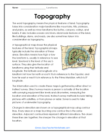
Topography
A topographical map shows the physical features of the land. Topographical maps typically include the elevation of these areas. Manmade features of the land, like buildings, dams, and roads, are also sometimes taken into consideration as topography.
Topography Questions
The information used to create these maps is gathered by either direct or indirect survey. Changes in elevation are shown on a topographical map using contour lines. Every area on a map touching one contour line is the same elevation.
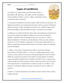
Types of Landforms
Buttes, canyons, valleys, and basins are all considered minor landforms. The largest and highest plateau in the world is the Tibetan Plateau. A plateau that has experienced a lot of erosion is called a dissected plateau.
QUESTIONS: Types of Landforms
How high does an area of elevated land need to be to be considered a mountain?
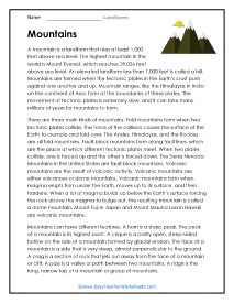
Mountains
A mountain is a landform that rises at least 1,000 feet above sea level. The highest mountain in the world is Mount Everest, which reaches 29,036 feet above sea level. An elevated landform less than 1,000 feet is called a hill.
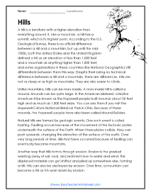
Hills
A hill is a landform with a higher elevation than everything around it. Like a mountain, a hill has a summit, which is its highest point. Natural hills are formed by geologic events. One such event is called faulting. Faulting occurs because of the movement of the tectonic plates underneath the surface of the Earth.

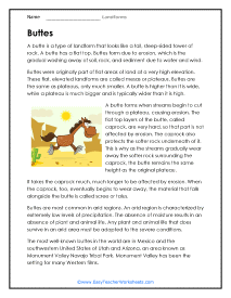
Buttes
Buttes were originally part of flat areas of land at a very high elevation. These flat, elevated landforms are called mesas or plateaus.

QUESTIONS: Buttes
Buttes are most common in arid regions. An arid region is characterized by extremely low levels of precipitation.
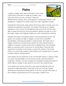
Plains
A plain is a large, wide area of flat land. Over a third of the Earth's land area is made up of plains, and there are plains on every continent.
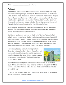
Plateaus
A plateau or mesa is a flat, elevated landform. Plateaus form over long periods of time as geologic forces push the Earth's surface up and water, wind, and rain wear the sides of the formation down.
QUESTIONS: Plateaus
Sometimes plateaus form when magma from deep down inside the Earth rises to the surface but is unable to break through the crust in a volcanic eruption.
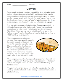
Canyons
The most well-known canyon in the U.S. is the Grand Canyon, which the Colorado River carved out of the Colorado Plateau.

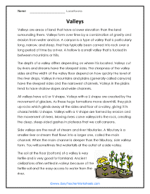
Valleys
Valleys are areas of land that have a lower elevation than the land surrounding them. Valleys form over time by a combination of gravity and erosion from water and ice.
QUESTIONS: Valleys
Ancient civilizations often settled in valleys because of the fertile soil and the easy access to water from the river.
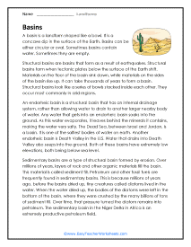
Basins
Structural basins are basins that form as a result of earthquakes. Structural basins form when tectonic plates below the surface of the Earth shift.

What Are the Different Landforms Found on Earth?
The Earth is beautiful, with numerous landforms to exemplify its beauty. Landforms are features on the Earth’s surface that are part of the terrain, including features under the oceans. There are so many landforms on Earth that you could spend years learning about every landform.
A quarter of the Earth's surface is land. Any natural physical feature of Earth's surface is called a landform. Landforms are classified a number of different ways, but one of the most common methods is based on position and formation. Slopes are formed by tectonic plate shifts and movements. They form "hill like" conditions. Common slope landforms include hills, cliffs, plains, and valleys. Coastal and Oceanic landforms form near seas and oceans. Common forms include coasts, coves, deltas, lagoons, capes, and peninsulas. There are landforms that relate to flowing water called fluvials. Common examples would be beaches, gullies, islands, marshes, oasis, rivers, streams, and swamps. Mountains and glacials include fjords, glaciers, mountains ranges, and summits. There are also landforms that relate to volcanic activity they are fittingly called volcanic landforms. Examples include geysers, mesas, and calderas.
Here are the six different landforms found on Earth:
- Mountains
- Plains
- Oceans
- Plateaus
- Valleys
- Deserts
Let’s delve deeper into these six different landforms and learn about what they are and how they are distinct from other common landforms.
1. Mountains
Mountains are any landmass significantly higher than its surrounding area. They differ from hills in that mountains are steeper, have narrower peaks than hills, and generally reach elevations higher than 2,000 feet (609.6 meters).
Due to their higher elevations, mountains tend to have sparse flora and fauna and colder temperatures at the summit compared to the base. Mountains occur both under the sea and above ground.
There are two main ways in which mountains are formed:
- Upward folding from tectonic movement.
- Accumulation of magma from below the Earth’s surface.
Upward folding occurs when two tectonic plates smash together and buckle under each other. The Himalayan Mountain Range is a perfect representation of upward folded mountains.
Another wayb mountains form is when magma accumulates under the Earth’s surface, then erupts onto the surface and consolidates above ground. These mountains are also known as volcanoes. The islands of Hawaii are a great example of these mountains.
Remember, it takes millions of years for mountains to form.
There is no definitive difference between mountains and hills, but hills tend to be smaller and less steep than mountains. Hills are most commonly formed from the buildup of rock debris and deposits. Hills can be formed both geologically and manually.
2. Plains
Plains are the most common landforms above sea level, accounting for more than 50% of Earth’s total land surface. They are large stretches of flat lands with no significant elevation changes.
There are two types of plains:
- Inland plains.
- Coastal plains.
Inland plains are lowland areas at the bottoms of valleys or mountains. They are grasslands in the United States and have some of the most fertile lands for agriculture. The Great Plains encompass Kansas, Nebraska, and North and South Dakota is a perfect example of an inland plain.
Coastal plains start from sea level and slowly rise until they connect to higher landforms, often piedmonts. A good example of a coastal plain is the Atlantic coastal plain, which runs along the East Coast of the United States, from the New York Bight to Georgia or Florida.
Plains are commonly formed from the eroded soil from hills and mountains, consolidating over millions of years. They may also form from deposited sediment from flowing rivers in valleys and at the bases of mountains.
3. Oceans
Covering more than 70% of the Earth’s surface, oceans are the most common landform worldwide. Earth has five major oceans:
- Pacific Ocean
- Atlantic Ocean
- Indian Ocean
- Southern Ocean
- Arctic Ocean
They are responsible for controlling Earth’s weather and climate by absorbing much of the Sun’s radiation and then distributing the heat it retained around the world via trade winds and ocean currents.
Despite being the most common landform on Earth, and consisting of 97% of Earth’s total water, only about 5% of the oceans have been explored.
Oceans were created from continental drift or the movement of Earth’s tectonic plates that created the continents we currently have.
4. Plateaus
Plateaus are flatlands at high elevations, surrounded and connected to other landforms by steep slopes. Essentially, plateaus are plains located at higher elevations. Depending on the plateau, its elevation can range from a few hundred meters to several thousand meters high.
Plateaus are sometimes considered a type of plain and thus make up more than 45% of Earth’s land surface.
They are created similarly to mountains, both from the upward folding of the Earth’s crust or the accumulation of volcanic ash and magma. The big difference in the creation of plateaus compared to mountains is that a significant amount of erosion occurs at the top of the plateau during formation.
5. Valleys
Valleys are areas in low-lying lands between hills and mountains. Depending on how they are formed, valleys are either “V” or “U” shaped.
They are formed from the movement of rivers and streams or glaciers. As rivers and streams flow, they erode the areas they cut through, and meet at a point, creating a “V” shaped valley. A “U” shaped valley is created when a glacier within a valley begins to melt and rounds out the “V” point.
The movement of the rivers and streams determine how steep the surrounding area of the valley is and how narrow it is.
6. Deserts
Found on every continent on Earth, deserts are landforms that receive less than 10 inches (25 centmeters) of rain in a year. Due to the lack of rainfall, there tends to be little vegetation, and plants that require very little watering.
While deserts are generally considered to be hot and sandy places, like the Sahara Desert, heat and sand are not requirements. In fact, the deserts in the Arctic and Antarctic, are the largest in the world and are always cold.
Deserts are located in areas of rain shadow, which are on the leeward side of a mountain or mountain range. Leeward refers to the side of the mountain or mountain range that faces away from the winds.