
These worksheets focus on teaching new material through reading passages and then assessing the comprehension of those passages through a series of questions. We also explore the concept of various components that contribute to this landscape and we explain the differences between continents and minor iterations of them in the likes of islands and what are considered to be micro continents. We will then break down each individual continent and touch on the concept of what is called a Supercontinent. This series of worksheets will definitely help your students become more comfortable with this topic while improve their reading proficiency. The collection of worksheets below starts by defining and explaining the concept of a continent. We then look at the key attributes of each of the seven major continents. We finish off by arguing that New Zealand may in fact fit the definition of being a continent by itself.
Print Continents Worksheets
Click the buttons to print each worksheet and associated answer key.
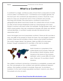
What is a Continent? Reading Worksheet
A continent is a large, continuous area of land that is composed of a kind of rock called "continental crust." Continental crust is largely granite.

What is a Continent? Multiple Choice Questions
The coldest continent is Antarctica. Antarctica is completely covered with ice.
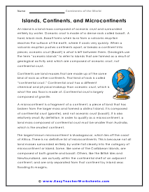
Islands, Continents, and Microcontinents Worksheet
An island is a land mass composed of oceanic crust and surrounded entirely by water.
Microcontinents - Short Answer Questions
Continents are land masses that are made up of the same kind of rock as other continents.
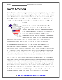
North America Worksheet
North America is the third largest continent, covering about 4.8 percent of the planet’s surface, and accounting for a little over 16 percent of its land area.
QUESTIONS: North America
North American fauna is plentiful and of the same variety as its climates, from forest-dwelling bears, to prairie dogs, to crocodiles.
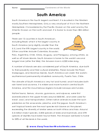
South America Worksheet
South America is the fourth largest continent. It is located in the Western mostly Southern Hemispheres.
QUESTIONS: South America
A number of islands are also considered part of South America, due both to their proximity and their cultural similarities.
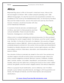
Africa Worksheet
frica is the second largest continent. With a billion people speaking over 1,500 different languages,
QUESTIONS: Africa
The climate of Africa is primarily dry desert in the north. The central and southern regions include savanna plains and dense jungle.
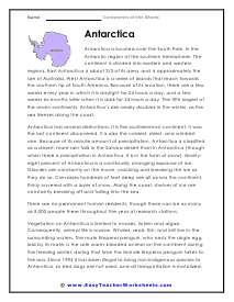
Antarctica Reading Worksheet
Antarctica is located over the South Pole, in the Antarctic region of the southern hemisphere. The continent is divided into eastern and western regions.
QUESTIONS: Antarctica
Antarctica has several distinctions. It is the southernmost continent. It was the last continent discovered.
Australia Worksheet
Australia is the smallest of all seven continents. A number of islands are also considered part of Australia, due both to their proximity and their cultural similarities.
QUESTIONS: Australia
There are many animals that are unique and native to Australia: kangaroo, koala, echidna, platypus and wombat.
Europe Reading Worksheet
Europe is the second smallest continent. It borders the continent of Asia on the northeast.
Europe - Short Answer Questions
Home to 731 million people, Europe is the third most populated continent.
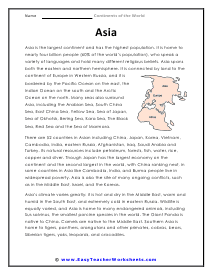
Asia Worksheet
Asia is the largest continent and has the highest population. It is home to nearly four billion people (60% of the world's population).
Asia Multiple Choice Questions
Asia's climate varies greatly: it is hot and dry in the Middle East, warm and humid in the South East, and extremely cold in eastern Russia.
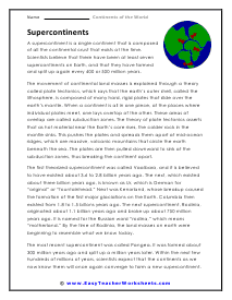
Supercontinents Worksheet
A supercontinent is a single continent that is composed of all the continental crust that exists at the time.
Supercontinents Short Answer
The most recent supercontinent was called Pangea. It was formed about 300 million years ago and split up a million years later.
What Are the Continents of the World?
Geography is a fascinating subject because it teaches us where places and groups of people are– which helps us understand the world. One key concept to learn is continents. But what exactly are continents, and how many are there worldwide?
The seven continents in the world include Asia, Africa, Europe, North America, South America, Oceania or Australia, and Antarctica. Continents are large, connected landmasses considered one region for geographical, political, and social purposes.
Sixty-percent of the population of the world lives in the continent of Asia. Australia, by comparison, is the least populated continent accounting for less than three-tenths of the world population. Africa is the hottest continent, on average, and homes the largest desert in the world. Antarctica is the coldest continent and is completely covered in ice. Antarctica also has no inhabitants; it is not hard to figure out why. Europe, which is composed of fifty-one countries, has the most developed economic and political union in the world. South America is home to the largest rainforest in the world. North America is often thought to house just three countries, but it is actually composed of twenty-three countries.
Let’s look at these continents to see why they are considered separate and what makes each unique.
1. Asia
Asia is the world’s largest continent in terms of size and population. Asia includes several groups of islands and a diverse variety of landscapes, climates, and cultures. It also has the longest coastline of any other continent.
This continent has a long land border with Europe. Some historians and scientists refer to the continents of Asia and Europe as one joint landmass, Eurasia. However, for practical purposes and in school, they are considered separate.
Asia also has subsections:
- Central Asia
- East Asia
- South Asia
- Southeast Asia
- Western Asia
It includes countries such as:
- China
- Japan
- Thailand
- The U.A.E.
- Jordan
- Turkmenistan
- Uzbekistan
- Russia (the Eastern portion)
2. Africa
The continent of Africa is the second largest in both size and population. It’s surrounded by the Mediterranean Sea, the Red Sea, the Indian Ocean, and the Atlantic Ocean. Africa is in both the northern and southern hemispheres.
Although Africa has diverse climates and stretches from both the northern temperate zone to the southern temperate zone, it is the hottest continent overall.
Africa has five subregions:
- North Africa
- West Africa
- Central Africa
- West Africa
- Southern Africa
Some African countries include:
- Egypt
- Morocco
- Nigeria
- Kenya
- Mozambique
- South Africa
3. Europe
Europe has a long land border with Asia. However, its rich history, culture, and politics unite these groups of countries, forming their own continent.
It’s the second smallest continent in the world but has a relatively high population density. Europe is the third most populated continent in the world.
Europe is in the Northern Hemisphere and is bordered by the Arctic Sea, the Black Sea, the Mediterranean Sea, and the Atlantic Ocean. An extensive land border through Russia divides this country into its Asian and European sections.
European countries include:
- Ireland
- Iceland
- Portugal
- Denmark
- Croatia
- Romania
- Ukraine
The majority of countries in Europe are in the European Union, a vital economic and political union helping represent the continent.
4. North America
North America is separated from South America by the Isthmus of Panama. It includes Canada, Greenland, the United States, the Caribbean, and all the countries of Central America.
This continent is in the Northern Hemisphere and almost entirely in the Western Hemisphere. It borders the Arctic, Pacific, and Atlantic Oceans and the Caribbean Sea.
North America is the third largest continent by size and fourth by population.
5. South America
South America is in the Western Hemisphere. While most of the continent is in the Southern Hemisphere, the top portion is technically in the Northern Hemisphere.
This continent has some extreme terrains. South America boasts the world’s longest river, the Amazon, and the world’s driest desert, the Atacama. Tierra del Fuego is the southernmost tip of the world outside Antarctica.
South American countries include:
- Suriname
- Colombia
- Brazil
- Argentina
- Uruguay
- Peru
6. Australia and Oceania
There is some debate over whether this continent is called Australia or Oceania. These terms can often be used interchangeably to describe the same region.
Australia is the largest landmass in this area. However, the continent also includes New Zealand and several islands, such as the eastern portion of New Guinea and Polynesia– including Hawaii.
Oceania is not connected by land to other continents. The Indian and Pacific Oceans surround it.
7. Antarctica
Antarctica is almost entirely covered in ice and is the only continent without permanent human residents. There are, however, research stations where people from various countries stay temporarily to conduct scientific studies.
There are no political borders, and the Southern Ocean surrounds it. Its closest countries are Argentina and Chile in South America.